Friday, July 30, 2010

"Who lives in Hortonville" - 7/29/10 - Swansea Rain Forest - Swansea, MA

- Trailhead: Swansea Library
- Riders: OMMB
- Distance: 8+ miles (late satellite lock on the GPS, straight line of the Google shot)
- Temp: 83
- Weather: HUMID
- Trail Conditions: wet from this morning's rain, but no issue
- Wildlife: 2 deer (an Indian could live forever in these woods...oh wait, wrong again)

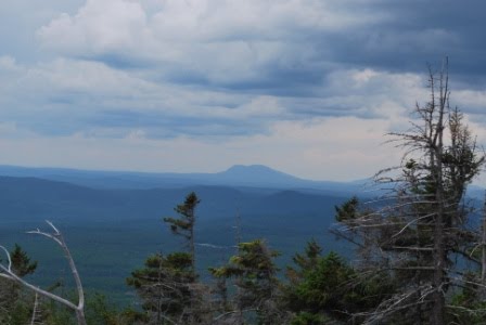
Notes: Pretty much a repeat of yesterday's ride, but took the express route out to where I wanted to "investigate". I shot straight north on the power lines, but you would have thought I ended up on the equator.  I started to wonder if old guys should really be riding in this weather!  After crossing the second tar road (Hailes Hill then Cummings Road), I found the single track I was looking for.  It's predominately kept clear by quads, but it's not destroyed and made for a good ride.  There were a couple of Hike-a-Bike dry stream crossings but that was the only ob-stacle. Crossed the Cole River without knowing it...real dry! There seems to be some loops here, but I think it's mostly an out-and-back ride.  I crossed a dirt road, which I found out was Swansea Water Dept land, and kept following the single track before turning around...it kept going, but not me, I was too hot and tired.  I took the dirt road back to tar and ended up in what seemed like the middle-of-nowhereville...it was actually Hortonville (some cross between Dr. Suess's Horton and Whoville I guess).  Nice old area.  A couple of lefts on the tar (seemed harder to ride than trails, weird) and I was back at the power lines.  South to connect to the loop from yesterday, then back to my 2-do's at home.

Tidbits:  Patrick's playing at Passim Friday night...how cool is that!!!

Happy Trails,
OMMB

PS-I noticed my track on Google is a little skewed South and East (North is to the right due to the elongated track), I wonder if I can fix that?

PPS-If anyone finds the time to ride, give me a call.  I can usually accommodate any day or time!

Thursday, July 29, 2010

"Stuck in the muck" - 7/28/10 - Swansea, MA

- Trailhead: Swansea Library
- Riders: OMMB
- Distance: 6 miles
- Temp: 77
- Weather: HUMID
- Trail Conditions: really, really dry

Notes: OMMB has a few days off from work to catch up on 2-do's around the house (and of course I took some time to ride).  I wanted to revisit the "north loop" in this area, Bob and crew from Bikeworks led me on a 12 miler here once.  Even though I got out in the morning, weather was real sticky (felt dogged immediately).  Even experienced dew flying up from the front wheel...doesn't happen often.  I did find the area, but not all of it.  So I plan to head there again (this afternoon).  All trails were real nice and dry...except where I attempted to cross a double track that is usually covered with 6 inches of H2O muck.  Well it was muck minus H2O!   Got stuck....in the muck. (looks like my bike took a horse sized dump, wasn't me!)


Tidbits:  Bradbury State Park Maine...Aug 6 - 9.

Happy Trails,
OMMB

So here's my "it's too humid" face...

Saturday, July 24, 2010

"Unhide the hidden Nuts" - 7/22/10 - Big River - RI

- Trailhead: exit 7 parking lot
- Riders: OMMB
- Distance: 5.6+ miles (some GPS holes)
- Temp: 80's
- Weather: perfect
- Trail Conditions: perfect
- Technical Level: off my chart
- Whoops, Yikes, and Oh Sheets:  too much hiking required, not much risk

Notes: Since I just HAD to figure out where this "hidden" trail was, I set out to where I figured it was based on Pete the RI NEMBA president's directions.  The trailhead is at the top of a slick rock, I knew of two in that area.  Found the hidden "Nuts" trail on the second rock searched (far right on the Google Track).  It's a VERY different trail than all in BR...different because it requires more hike-a-bike than pedaling!  The trail is extremely technical in respect to the balance and slow ride control required...it's more of a trials ride than typical trail ride.  If you want to hike a nice trail in the middle of your BR ride...try this one.

Tidbits:  According to Pete, it's the hardest "engineered" trial in RI.  I'm not sure I know anyone that could ride the whole trail without issue (maybe Dr. E could come close).  There's an offer for a case of beer for the first person to do it...hasn't happened yet. 

Happy Trails,
OMMB

Thursday, July 22, 2010

"Whoops" - 7/20/10 - Big River - RI

- Trailhead: Exit 7 Commuter Parking Lot
- Riders: T, Mark, OMMB
- Distance: 9 miles
- Temp: upper 80's
- Weather: humid
- Trail Conditions: dry

Notes: The intent of this ride was to show the "new to OMMB" area of Big River near exit 7, between Division Rd, North side of New London Turnpike (NLT), and Rte 95.  Maybe cover 5 miles or so.  We started out okay, with nice smooth single track from the parking lot, but it didn't last..."did I miss something that I rode the other day??"  The cool single track didn't amount to much of a ride sooooo "we" went exploring the South side of NLT to find a route to Carr Pond. I couldn't find a trailhead into the North side of the Carr Pond area and ended up at a million dollar cul-de-sac.  Decided to turn back and head back the other direction on NLT to more familiar trails...I dragged my riding partners along.  To avoid the climb to Carr Pond, we followed a trail in the direction towards Tarbox Pond.  There were some mud crossings but not too bad.  We circled Tarbox on some pretty technical singletrack and looped back to NLT on the Pump House trail...fun.  It was time to bail out of this unexpectedly long ride so out to Division Road we went.  At the lot, "whoops" we ended up logging 9 miles!  It's crazy how one small part of BR can turn into almost 10 miles.

Tidbits: a freakishly friendly rider came up to us in the parking lot before the ride and urged us to follow him to the "hidden trail" called "Nuts"...sounded suspicious to OMMB.  The trail was advertised as a 1.5 mile technical trail.  We didn't bite, but my curiosity was definitely aroused.  I emailed the NEMBA Big River Chairperson (Al) and the RI NEMBA President (Pete) and asked if they knew of this "hidden trail" (since it was not labeled on their maps).  I find out that the freakishly friendly rider was freakishly friendly Pete!!  I only knew him by name, not by sight.  Pete gave me the general idea of where "Nuts" is hidden and I was determined to unhide it.  To be continued....

Happy Trails,
OMMB

Monday, July 19, 2010

“Back on two wheels” - 7/15/10 - Big River - RI

I set out to hit an area I hadn’t focused on since Pat and friends started riding here over 10 years ago.  From the Hopkin’s Hill parking lot, headed out the left side trailhead and all the way down the hill.  As I remember, it was a pretty rough area down at the bottom...memories of someone permanently "denting" her leg and another splitting his helmet into three came to mind (not mentioning any names).  I continued through the area keeping the water to my left.  I unexpectedly ended up finding some VERY nice single track (I’m talking smooth as Kingdom Trails nice).  Surprising to me, I really have NOT travelled all the possible trails in Big River.  The area I found mostly straddles the New London Turnpike (dirt road) and some good stuff lies between Division Street and Rte 95.  Only negative thing I could say is that you can hear the sound of the highway throughout most of the area…but the single track was excellent! If I were to bet, I’d say that NEMBA or someone has been adding to these unmapped trails over the years.  There’s even another man-made bridge ramp thingy like the seesaw.  I ended up with over 7 miles logged.


Saw a LOT of wildlife including 2 deer, 1 baby toad, 1 baby frog, chipmunks and squirrels by the dozen, a huge crane/herring looking thing, and some giant squirrel gopher woodchuck mix that I have no idea how to identify.  It was near some rock caves and was able to climb the side of the rock outcropping (so I know it wasn’t your standard woodchuck).  Could it have been a rare giant weasel or mammoth cave squirrel?  I’m stumped!

The trail conditions were VERY dry and the single track, although "new", was packed solid.  Did I mention dry?  So dry that I think I rode through what was once a pond or swamp...you can see the water on this Google Earth shot (the parking lot is the Exit 7 Commuter Parking).


Weather was humid and there was this very bright thing in the sky...something I hadn't seen in a while!

Happy Trails,
OMMB

Sunday, July 18, 2010

Weekend of Hiking Trail Report Day 1 - 7/9/10 - Baxter State Park - Millinockett, Maine

Day 1 of 3 - "Lean-to for two please"

We arrived at our very exclusive (elusive) campsite within Baxter State Park in Mill-of-no-where-nockett Maine to find that we were "roughing it" a little more than originally expected. The campgrounds within the state park have no running water, stores, ice, etc...all water source is from the nearby stream. LUCKY for us the stream was right next to our site. We were also located near the Abol trailhead (to Mt Katadhin), very convenient. Although small, the site was at the end of a dirt road and had a picnic table, fire pit, and lean-to. About that lean-to...the site was booked as a four person site, but our two person tent just barely fit in the lean-to. With no room for another tent on the site, four people, had anyone joined us, would have been VERY cozy! This potential coziness, with the lack of showers for the weekend, didn't stop the boys at a neighbor site from piling into the lean-to (yeah, they were from Maine). Other than the sour out-house, OMMB liked the site.

Next to us was the Abol Stream Falls trail. So we took the short hike (1.6 mile total) to get the legs (and hip joints) loosened. We were annoyingly escorted by those high performance flies (deer flies?). They were so protective of us that they had to just keep flying by our ears to let us know they were watching over us...I guess to help keep away bears and mountain lions (which would have been more pleasurable than these flies). Thankfully they were non-existent at the waterfall. Along the trail we saw red squirrels, a toad, and fish in the stream. The small waterfall with crystal clear water was well worth the hike.


We returned to our campsite for dinner and enjoyed the sound of live acoustic music from the "four boys in a lean-to" site near us...it was awesome sitting by the fire listening to them. Good voice, decent guitar and harmonica...didn't suck!

Don't you hate it when goats show up in your fire?  I personally find it quite disturbing.


Good stuff - clear stream running next to the site, short hike to the waterfall, Abol Trailhead a few feet away, not many bugs, nice dry lean-to to stuff the tent into, acoustic singer/guitar playing next door

Not so good stuff – no shower, sour out-house, lean-to for four?


(Remember to check You Tube for the videos)

Happy Trails,
T and OMMB

Saturday, July 17, 2010

Weekend of Hiking Trail Report Day 2 - 7/10/10 - Baxter State Park - Maine

Day 2 of 3 - "Land of torrential rain and bull moose"

After a pretty comfortable sleep, off the ground in the lean-to tent suite for two, we were awoken around 6am to the familiar sound of rain.  Familiar to us because that's what it does when we go camping or to Florida.  But this wasn't your normal rain, it was a torrential rain storm!  I actually thought the freaky fire goat cast some kind of spell on us causing the stream to be re-routed over our lean-to.  Well if it wasn't for the lean-to, we may have headed straight home right then and there. 

The rain stopped and we crawled out around 10am.  The weather report for the mountain sounded grim, but we decided that even if we just hike for exercise, anything else we see would be a plus. So off we went to the Roaring Brook Trailhead.  The map indicated that Basin Pond was about half way to Chimney Pond.  "Half way is good"  ...we planned to assess status once we got there, since we were starting the hike past the recommended departure time for Roaring Brook to Chimney Pond.


The trail was a great choice, it was sheltered most of the way and initially ran along the brook.  The incline gradually steepened, eventually to the point where rocks had to be clamored.  Some nice bridges and viewpoints along the way, no bugs, and only a few hikers met on the trail.


We made it to our half way goal, Basin Pond...the clouds on the summit and Knife Edge were clearing, giving us GREAT views! 


Inspired by these views at the half way mark, we decided to continue up to Chimney Pond.  Even though the 3-D models of Katahdin on display at most ranger stations made this trail incline appear to be non-existent...it existed. This portion of the hike was more difficult than the first half.  Really not much wildlife along the way, a toad that high tailed it off the trail as we approached (must have seen what happened to his buddy when some hiker didn't watch where he stepped), and quite a few red squirrels.  Passed a few hikers carrying full gear for camping at Chimney Pond...we tried to imagine it for next time.

We arrived at Chimney and after passing through the camping area ("hey they have those cool lean-tos"), past the "bear line", which is a community area where campers hang their garbage on a rope strung between trees (when I read the sign all I could picture were bears in line for the buffet table!), and past the rangers station where we signed in, low and behold was the Pond!  It was awesome!  Great views of Baxter Peak, The Knife Edge, Hanley Peak, and all the features that make up the South Basin.  Observing the incline to reach the peaks made me wonder how this hike could be done in one day...would have to be a very long day!  We looked at each other and both agreed that I would need to slap Mr. Gong up side the head.  He's the guy at work that recommended a loop (a "day hike") that included the summit.  Camping at Chimney Pond then hiking the summit/Knife Edge loop the following day, would be more to our liking...some day.


We sat and had our lunch next to the pond and took pictures for about a half hour with only the occasional annoyance of fellow Americans...the kind that just don't shut up.  We did hear some rumors of a moose that frequents the pond, but figured that moose sightings were simply legends to attract tourists to northern states, and there really weren't such things as moose.


So just as we grabbed the last few pictures and ingested the scene, OMMB spotted something move between two trees on the other side of the pond.  Hey, it moved again, could it be?  Holy Moose it was a Cow...I mean Holy Cow it was a Moose!!!  Like a real moose, with giant antlers, not just the talking mechanical moose head at Buggaboo Creek, but the whole body and everything including...uh, yeah it definitely was a male!!  We spent at least another 30 minutes taking pictures and video of this guy.  John Holmes the moose even made his way to the water for a drink, but didn't partake in the full body dip...must have had his bath this morning.


 Dude...we can still see you...


Satisfied that we had seen him do his moose stuff long enough (which was eat, mope around, eat some more, mope around, look around, eat some more...pretty good life) we started back down at 5:00.


hmmm...this leaf got me thinking if G&Ts on the way down...


We got to the parking lot to find that we were one of three cars left, and Ranger Rick was checking tags on the vehicles to figure out who he had to worry about.  Two groups, including us, were accounted for...Rick had only one car to worry about tonight...his life is exciting as the moose's.

This 6.6 mile hike to an elevation of 2,914 feet, and the Mega-moose sighting, fulfilled the trip!  And we still had another day ahead....


Happy Trails,
OMMB and T


Friday, July 16, 2010

Weekend of Hiking Trail Report Day 3 - 7/11/10 - Baxter State Park - Maine

Day 3 of 3 - "Straight up AND on the rocks"

Feeling refreshed after an evening bath, ready to push up another trail on our last day here!  Even after Zippy the Mouse woke me up three times when trying to get into one of our cooking pots.  He was so fast I could hardly keep the flashlight on him!  I was glad it wasn't something larger.  So just how does an Azorean OMMB have a "bath" where there is no running water?  Well...just like a moose of course (keep the comments to yourself)!


We decided on the Abol trailhead at the campground.  Ranger Rick had recommended getting to the "Tabletop" area on top of the "slide" for some of the best views in the park (unobstructed views West). 


This trail starts out as a nice walk in the woods with a very gradual incline.  You could even bike up this for quite a while with not many obstacles.  Then something happens, the trail gets really pissed, and sends you STRAIGHT UP the remnants of a massive rock slide.  Dear trailblazers...have you ever heard of a freakin SWITCHBACK???  Jeesh!  

On our way up, we could hear a group waaay up on the slide making a lot of noise...I said "sounds like someone got hurt".   Well we met the group on their way down, most were bitchin about the one who took a head dive forward and broke his finger.  They weren't too happy about not reaching the top.  Johnny "Knocks"ville had his finger wrapped in a T-shirt and was pretty scraped up.  Couldn't even offer him any Ibuprofen (which reminded me that I once again left the first aid kit at the camp).

So we clamored up a bit more to the bottom of the Abol Slide, which provided a great view.  From there on it was REAL steep but we could see how one could reach Baxter Summit in a day from this trail.  We hiked about 3 total miles to 3003 feet.  (333? I hope that's not the Fire Goat's number)

We had lunch and called a day, a weekend, a trip to remember...


Happy Trails,
OMMB & T